
 |
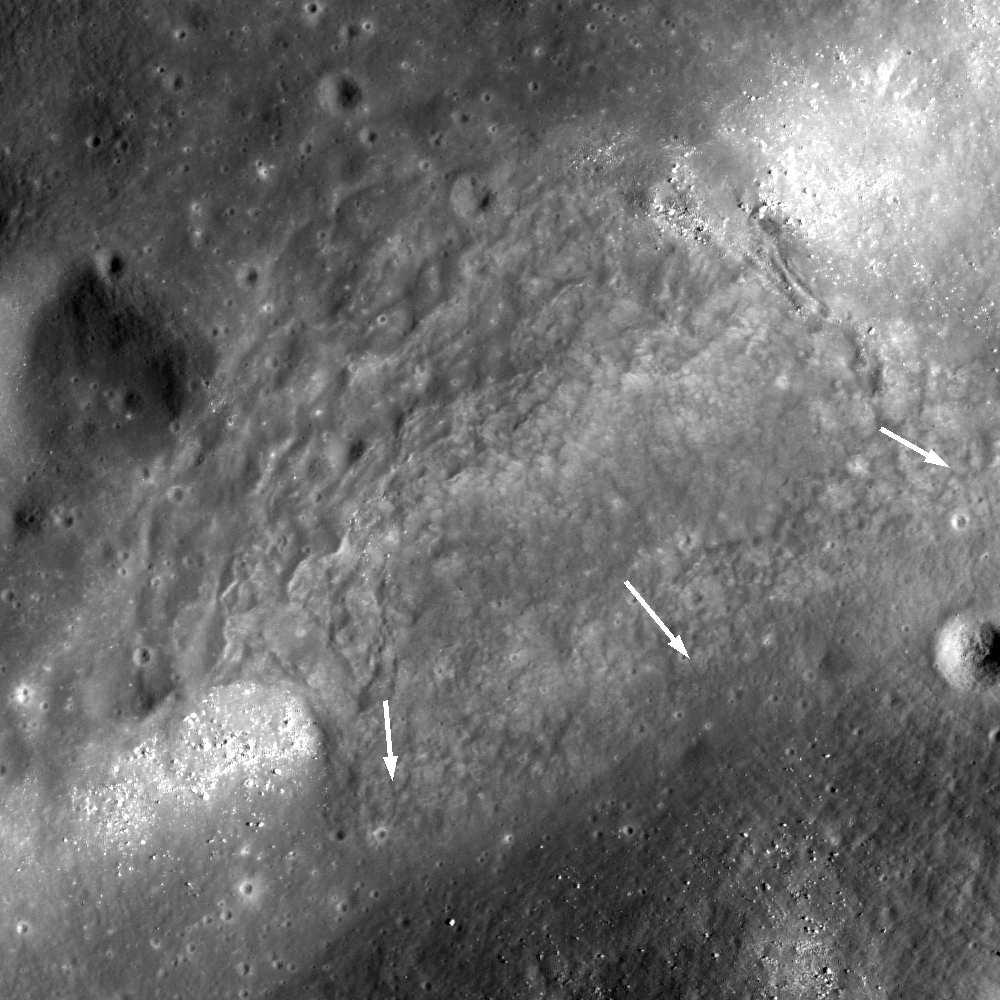
| Rock and debris slumped from northwest to southeast (upper left to center) and cascaded into the floor of a linear topographic low (depression or graben) near Milichius crater; arrows indicate the direction of movement. 1.2 km field of view from LROC Narrow Angle Camera (NAC) observation M190794864L, spacecraft orbit 13160, May 4, 2012; 46.88° incidence angle, resolution 1 meter per pixel from 122.34 km [NASA/GSFC/Arizona State University]. |

LROC News System
A linear topographic low (a depression or graben) located southeast of Milichius crater (9.342°N, 330.646°E) shows tell-tale signs of mass wasting, the ongoing process of erosion that levels out surface topography (see figure below). A large mass movement, more than 1 kilometer across, eroded part of the depression wall near its southwest end (see opening image). Unlike the example of mass wasting highlighted in Tuesday's Featured Image of Schubert A crater (January 14, 2014), which resulted from many small individual rock movements, this material likely moved as one large unit. Was this the result of a landslide or of a slump? Understanding how landforms erode tell us about their properties including angle of bedding planes, composition (such as rock or soil), and mechanical properties such as shear strength (the ability to resist downslope movement).
 |
| Slightly wider field of view, showing the segment of the linear depression, from LROC NAC M190794864L [NASA/GSFC/Arizona State University]. |
 |
| The depression with the nominally contiguous length to the northeast is visible at the center of this 34 km field of view from LROC Wide Angle Camera observation M129486143CE, orbit 4215, May 26, 2010, 56.85° incidence angle, resolution 58.3 meters from 41.48 km [NASA/GSFC/Arizona State University]. |
 |
| Additional context in this 74 km field of view, from the same LROC WAC observation stitched together with a similar observation of the same latitude during the sequential orbit, shows the significant bright ray debris from Kepler, to the west, and Copernicus, to the east; both outside this frame. 12.19 km Milichius crater is at upper left and 3.76 km Milichius K is above lower left [NASA/GSFC/Arizona State University]. |
Explore the full NAC image, HERE, to look for more landslides in this area. Which of these is likely to be of a much older age?
Related Posts:
Aristarchus Plateau 1 Amazing Geologic Diversity
Fresh Copernican Crater
Rim on a Rim
Rock slide in Rima Hyginus
No comments:
Post a Comment